blah blah blah
Webster Slide Mountain and Wachipauka Pond
Length: 6.5 miles out-and-backDifficulty (click for info): Moderate
Elevation Gain: 1480 feet (+580 on return)
Rating (click for info): 6/10
Elevation: 2173' (summit) 1495' (pond)
Prominence: 451'
Driving Directions:
Trailhead and parking area are on Rt. 25 in Warren, NH. Look for a wide gravel pull-off on the west side of the road, 4.3 miles north of the northern junction with Rt. 118 and 9.5 miles southeast of Rt. 10 in Haverhill. Click here for a Google map.
About the Hike:
The hill country on the soutwestern extent of the White Mountains has some common features - low elevations with rugged terrain and ponds. One such example is the combination of Webster Slide Mountain and Wachipauka Pond, where a sheer cliff rises above a serene, secluded pond. A moderate-length hike over rolling hills will take you to the plateau where one way leads to the mountain and one way leads to the pond. You'll get to experience both the peaceful shoreline views and the airy, birds-eye perspective from the meadowy mountaintop. Both are short side paths off of a quieter section of the Appalachian Trail. It's a great half-day trek with plenteous opportunity for solitude.
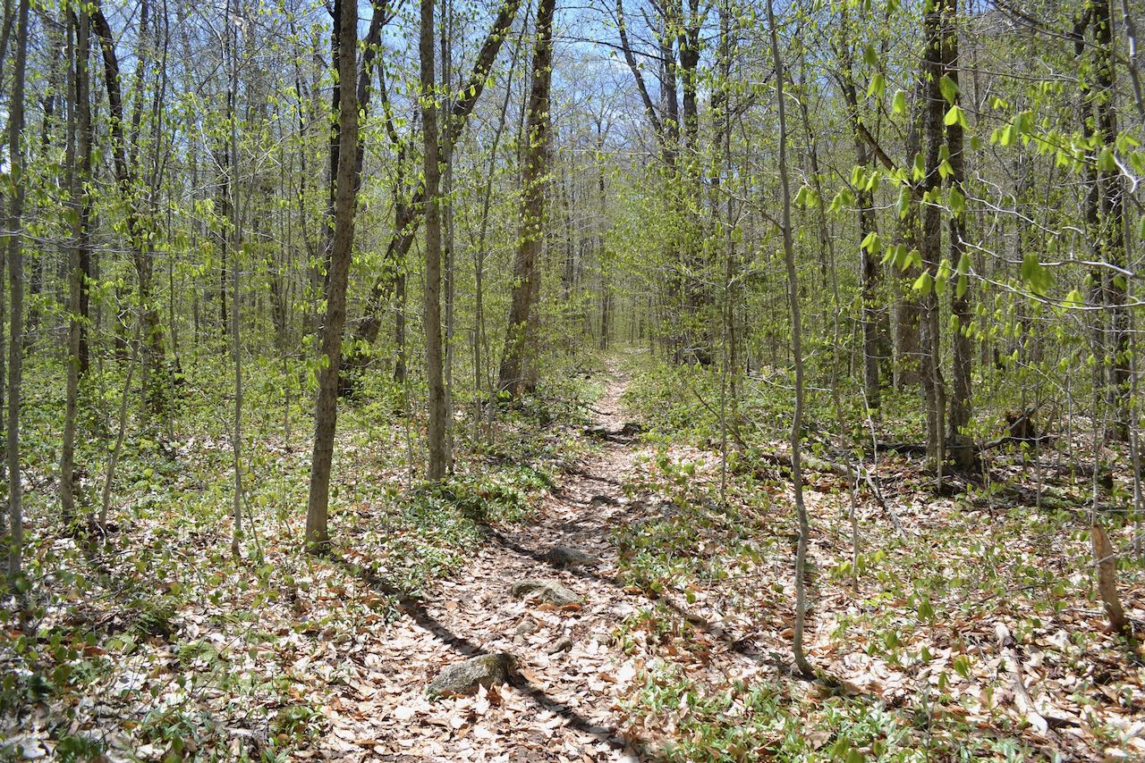
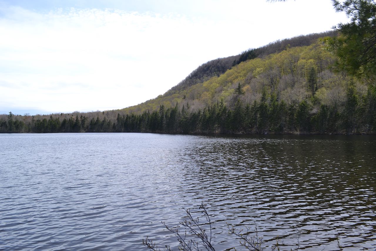
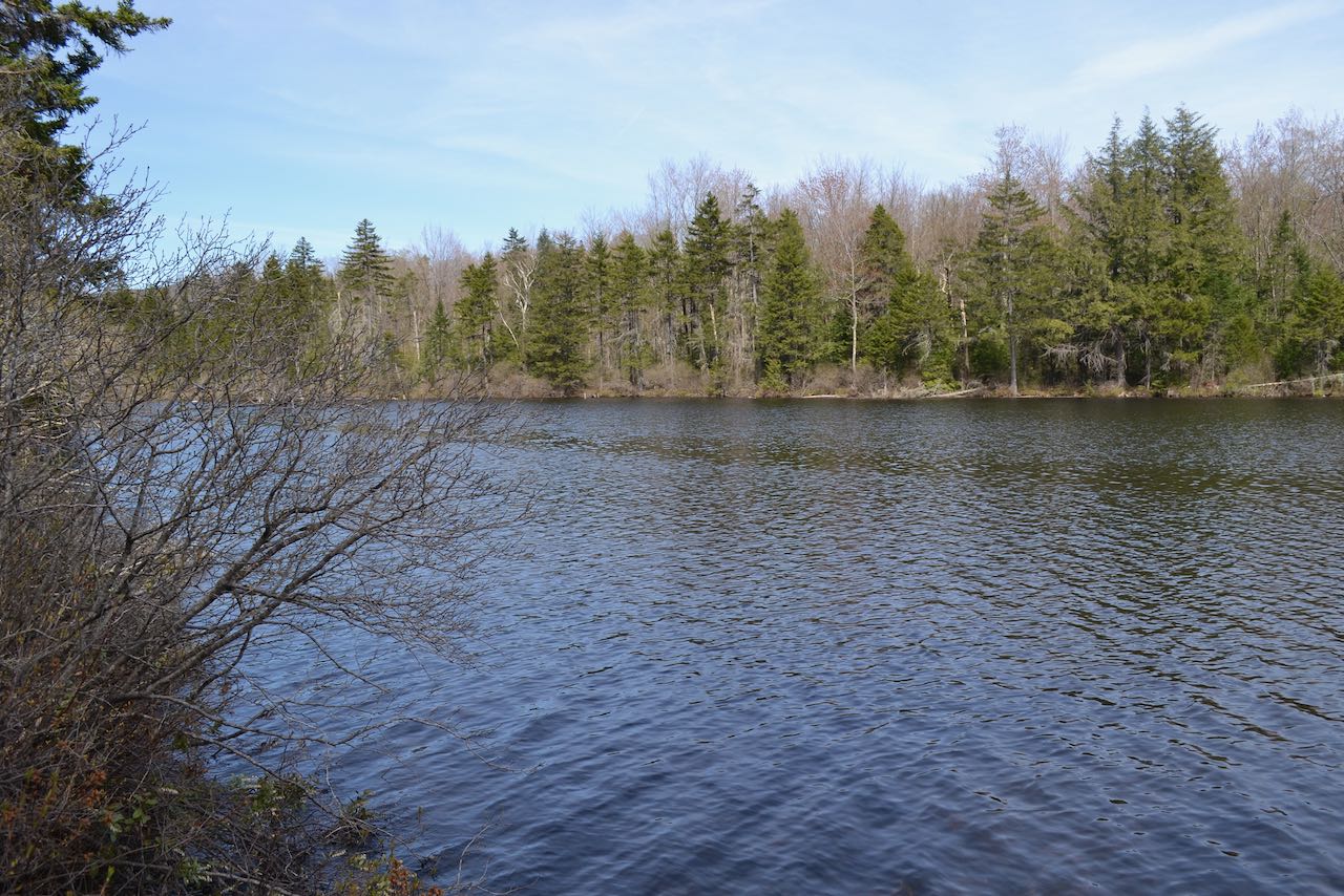
From the pull-off on the west side of the road, head out on the Wachipauka Pond Trail past the end of a field, crossing the bed of an old railroad. The trail skirts by the side of a low swamp surrounded by hemlocks and then begins to circle around the west side of the mountain closest to the road, Wyatt Hill, which stands in between you and Wachipauka Pond. The trail remains relatively flat along the base of the mountain for the first half mile, weaving through moss-covered rocks. As it begins to slope up, it makes a sharp turn around to the right and climbs diagonally up through brighter woodlands. A long, roundabout ascent of the hill now commences. After climbing moderately for 0.15 miles, it levels off for a tenth of a mile. Then, it continues to circle around, climbing a steeper section for 0.2 miles, leveling off again, and approaching its highest point on the hill in another quarter mile, with rocks strewn across the forest floor all around. The trail now descends easily through the same open, deciduous forest, reaching a low point after half a mile. The trail crosses some bog bridges and runs across a flat area for 0.2 miles to approach the north end of the pond. Crossing a walkway of stones, the trail begins to rise along the hillside just below the cliffs of Webster Slide Mountain. In 0.4 miles, you have passed by to the other side of the cliffs and you reach a four-way intersection, just after crossing a little stream. The Wachipauka Pond Trail continues straight, eventually reaching Rt. 25C. To the left, a spur path descends 0.2 miles, crossing back over the stream, to a point on the northern shore of the pond. From here, there is a pleasant view across the breadth of the water. The sharp slope of Mt. Mist rises in the background on the right side of the scene. Beaten paths continue to the left along the pond toward a northern finger, passing one nice grassy spot right at the waterside.
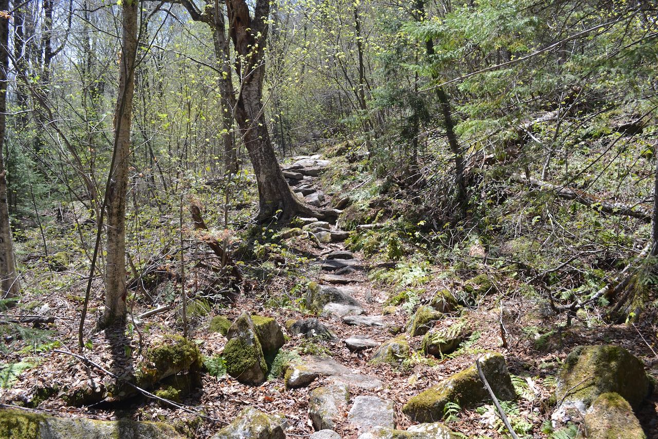
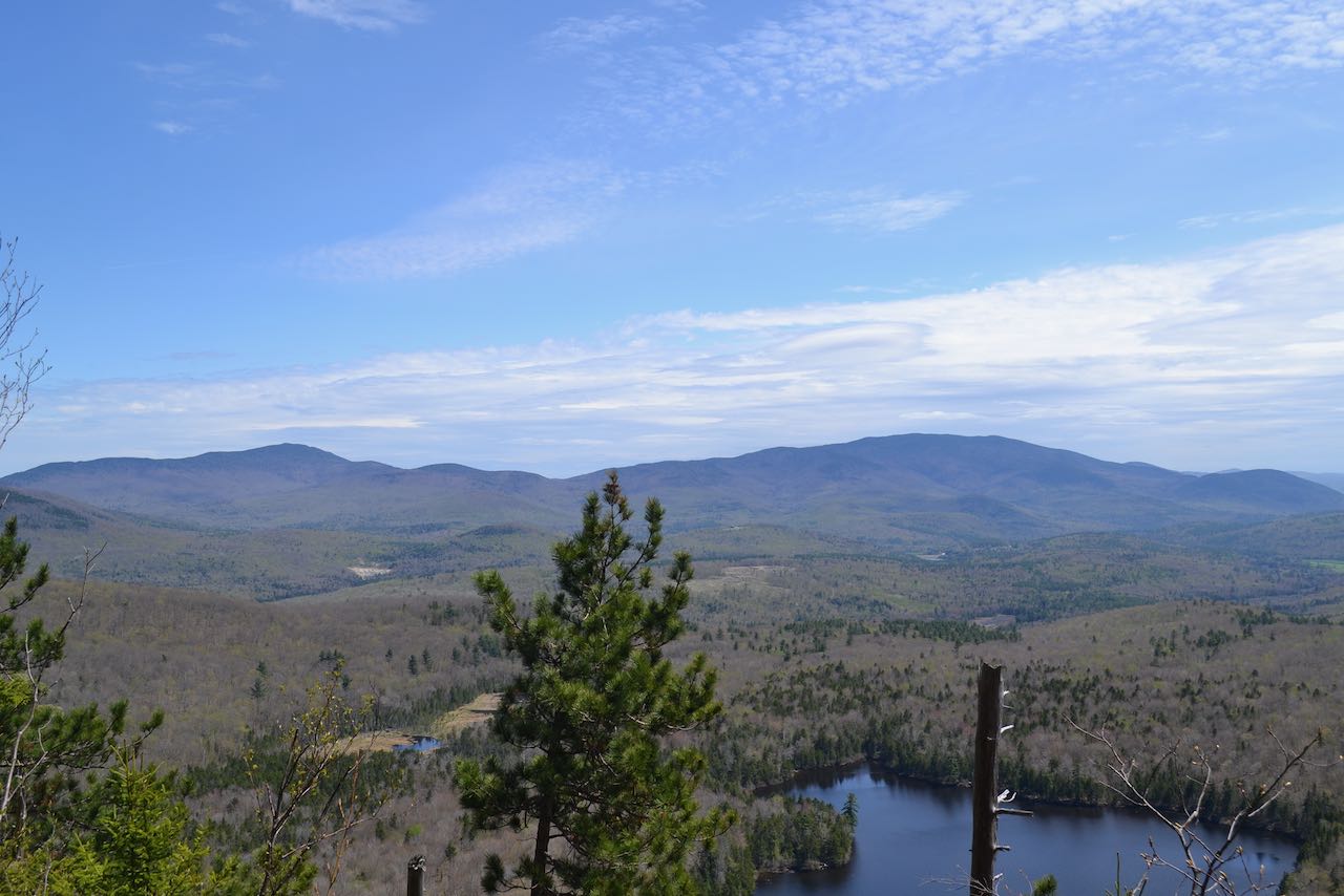
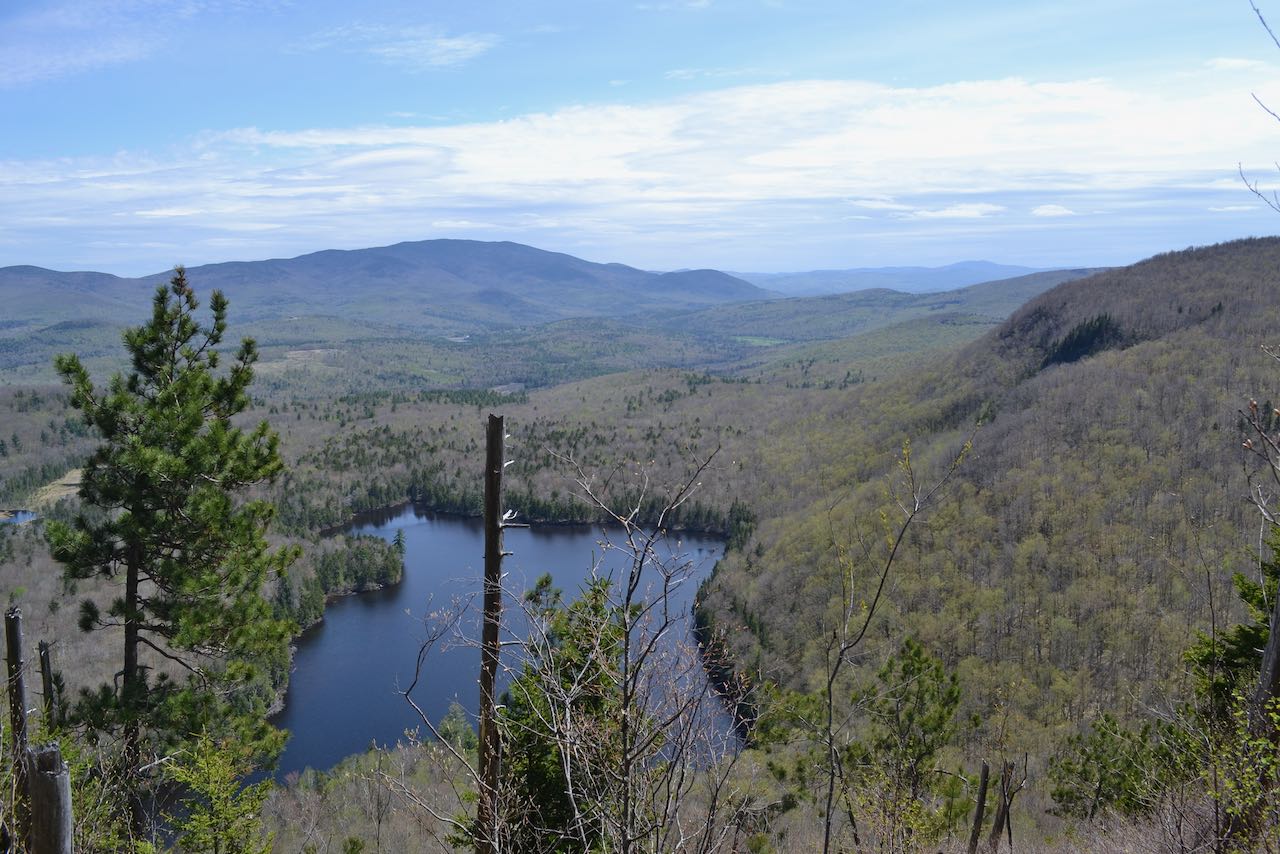
Back at the four-way junction, to the right (across from the spur to the pond) is the Webster Slide Trail, which will take you up to the top of the mountain. This trail climbs briefly and runs flat through the col between Webster Slide and Mt. Mist for a quarter mile. It then attacks the harsh mountainside, climbing very steeply over roots and rocks. The trail jogs right at the steepest part and begins to moderate after just 0.15 miles. It climbs more gradually for 0.2 miles to the summit of the mountain and then descends a short distance to a semi-open clearing just above the cliffs. For the best view, follow the path heading straight downhill. Cautiously walk along it as it bears to the right and leads steeply down to an open area where you can enjoy a nice view directly over the pond. In the background is Carr Mountain, rising above the Baker River Valley. In the distance beyond the valley is Mt. Cardigan. On the right side of the pond is Mt. Mist. To the left of Carr are Mts. Kineo and Cushman, and further over through the trees, you may be able to see some of the ridge rising up toward Mt. Moosilauke.
Printable directions page